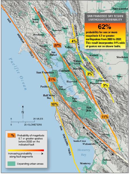
A map of the San Francisco Bay Area from Santa Rosa to Monterey.  The land is tan, shaded for terrain, and green for densely populated areas.  The ocean is light blue.  Seven fault lines, shown varying from yellow to orange, extend diagonally from top left to bottom right.  The San Andreas Fault, marked orange and 22%, runs just off-shore north of the Golden Gate, then bends slightly inland, passing just southwest of San Francisco and just west of the Peninsula cities and Silicon Valley.  Pacifica, Half Moon Bay, Santa Cruz, Watsonville, Salinas, and Monterey are the labeled cities west of it.  Other faults are shorter. It is a USGS seismic hazard map showing a 62% probability of an M6.7 or greater earthquake occurring in the San Francisco Bay Area between 2003 and 2032.

We Have Solar at Home Part 2: How Much Will It Cost?
Overheard in SF
Dodgers|Giants|Analysis: What good is bad data?
Biden, like SFUSD, like White San Francisco parents, like most Democrats, does not support busing
Overheard in San Francisco
SFUSD Lottery
A rare sentiment